.svg)

Karlskrona’s geography and heritage have long shaped its identity - but today, they also present barriers to growth, mobility, and housing. This proposal reimagines the mainland north of Karlskrona as a strategic extension of the city: a place to unlock existing infrastructure, support sustainable development, and build resilience for the future. Rooted in local context and driven by long-term vision, it offers a path forward for a more connected, liveable, and dynamic city.

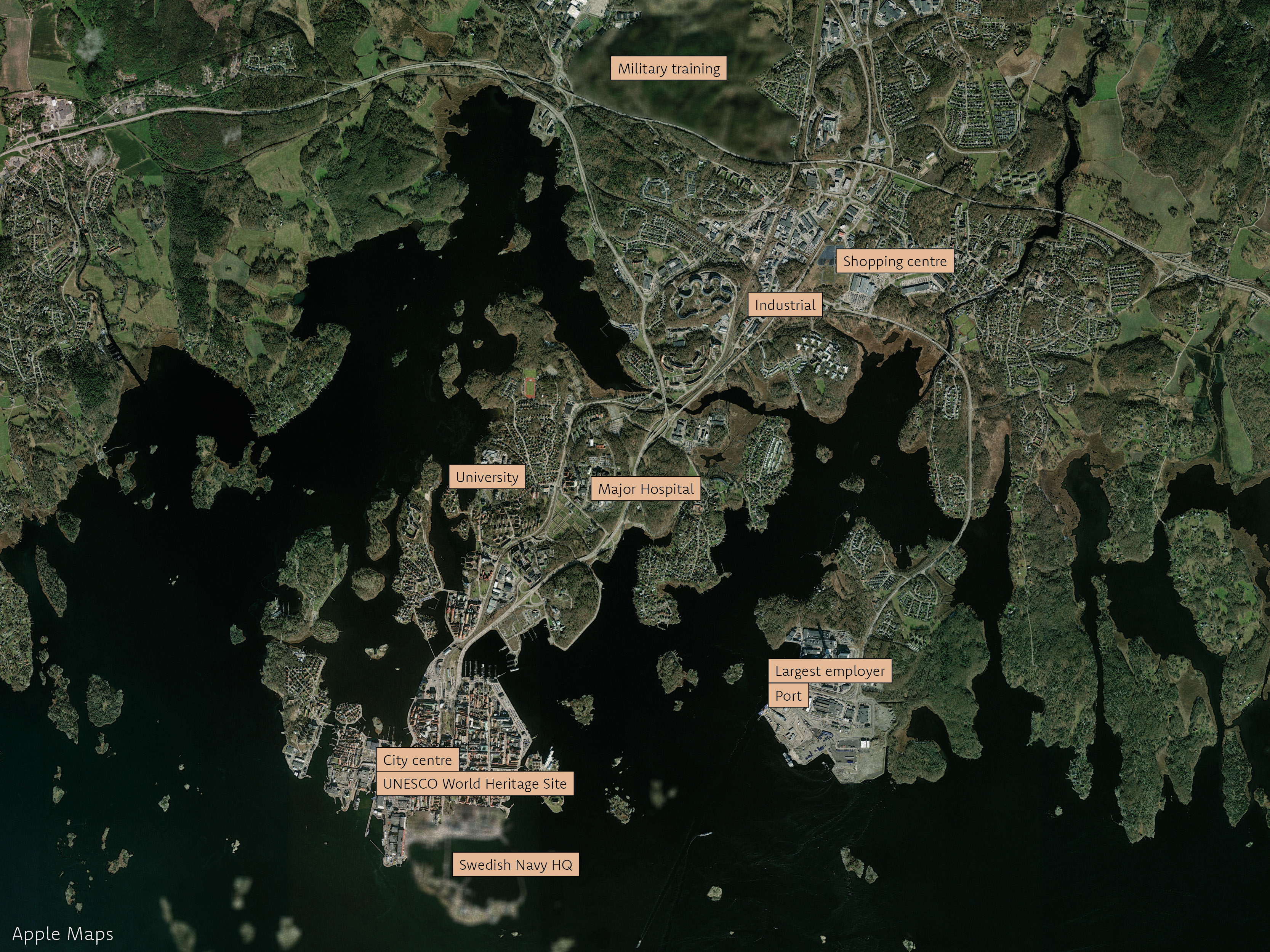
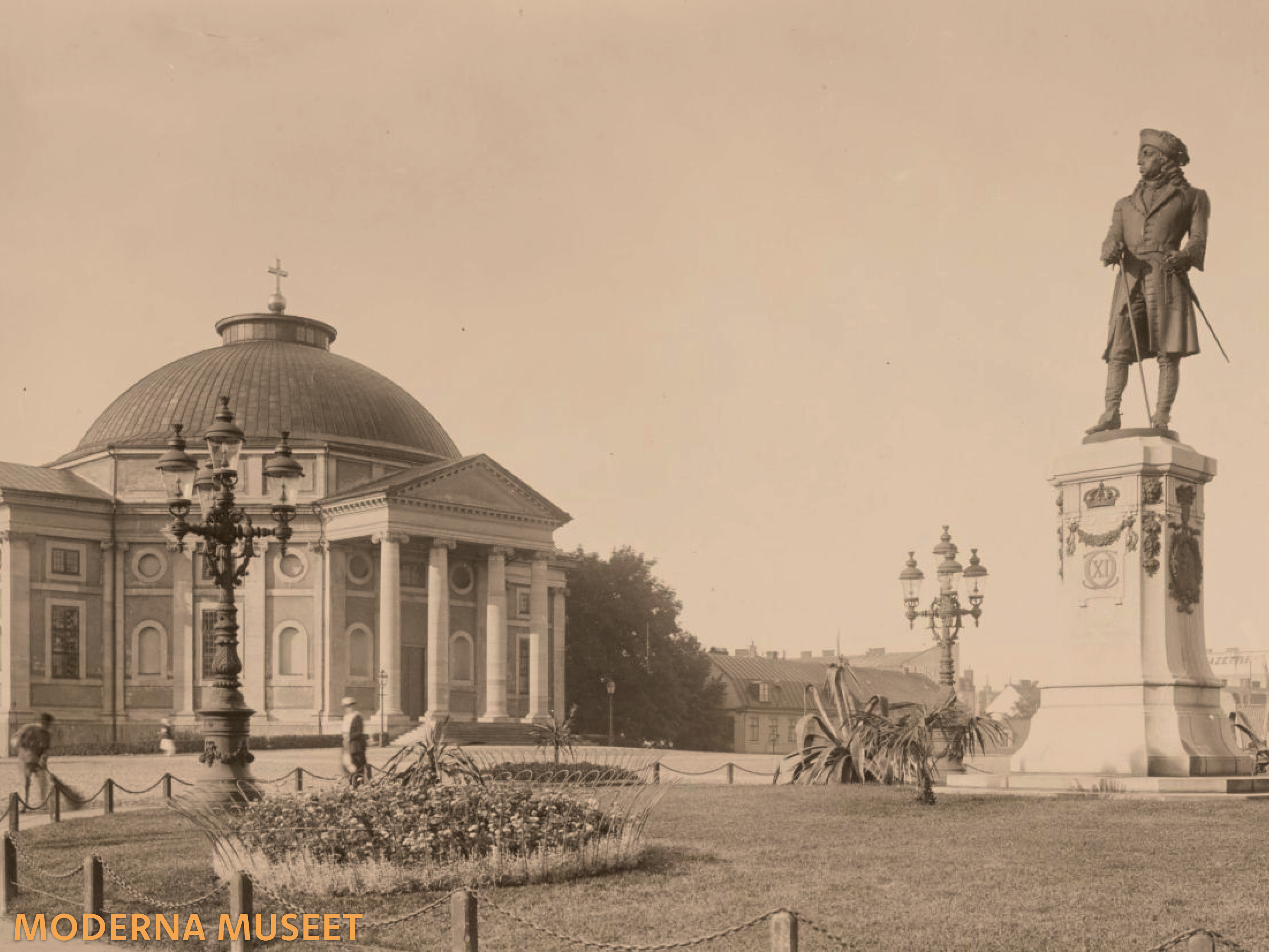
Karlskrona, the regional capital of Blekinge County in southeastern Sweden, is beautifully situated on islands within a breathtaking archipelago. The city holds historical significance, as the crown ordered the relocation of the navy to Trossö Island in the 17th century. This move led to the establishment of a groundbreaking naval port and shipbuilding facilities, much of which remains intact today. This rich architectural heritage earned the Karlskrona Naval Base UNESCO World Heritage status in 1998. The city is renowned for its exquisite baroque architecture, considered among the finest in northern Europe.

The city boasts a direct rail connection to Malmö and Copenhagen DK, via the Öresund Bridge. However, there is currently no direct railway route heading north towards Stockholm. Trossö offers ferry services to the archipelago islands and Verkö hosts a major ferry port that connects with Gdynia PL.
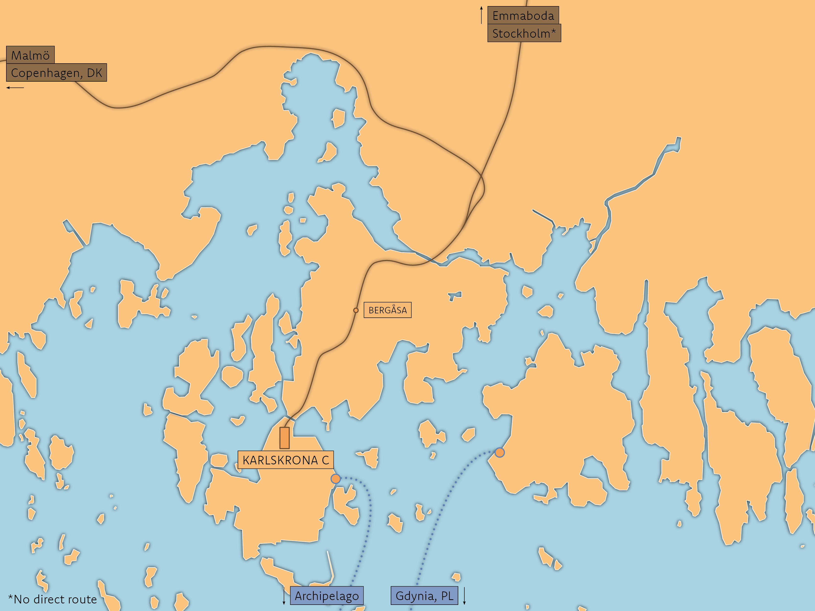
The city center is primarily located on Trossö and extends northward, featuring a significant area of single-family homes, a university, and a hospital on Vämö, near Bergåsa station. Additionally, there is currently industrial and car-centric development on the mainland, 'fastland' in Swedish. The largest private sector employer in the municipality is NKT, a leading manufacturer of undersea cables, with its facility situated next to the ferry port.


Karlskrona and the region have incredible yet underutilised assets:
Today's sprawling appoach does not address these issues:
These issues are stifling innovation and prosperity, as well as preventing the city from being an attractive place to live, work, and play.
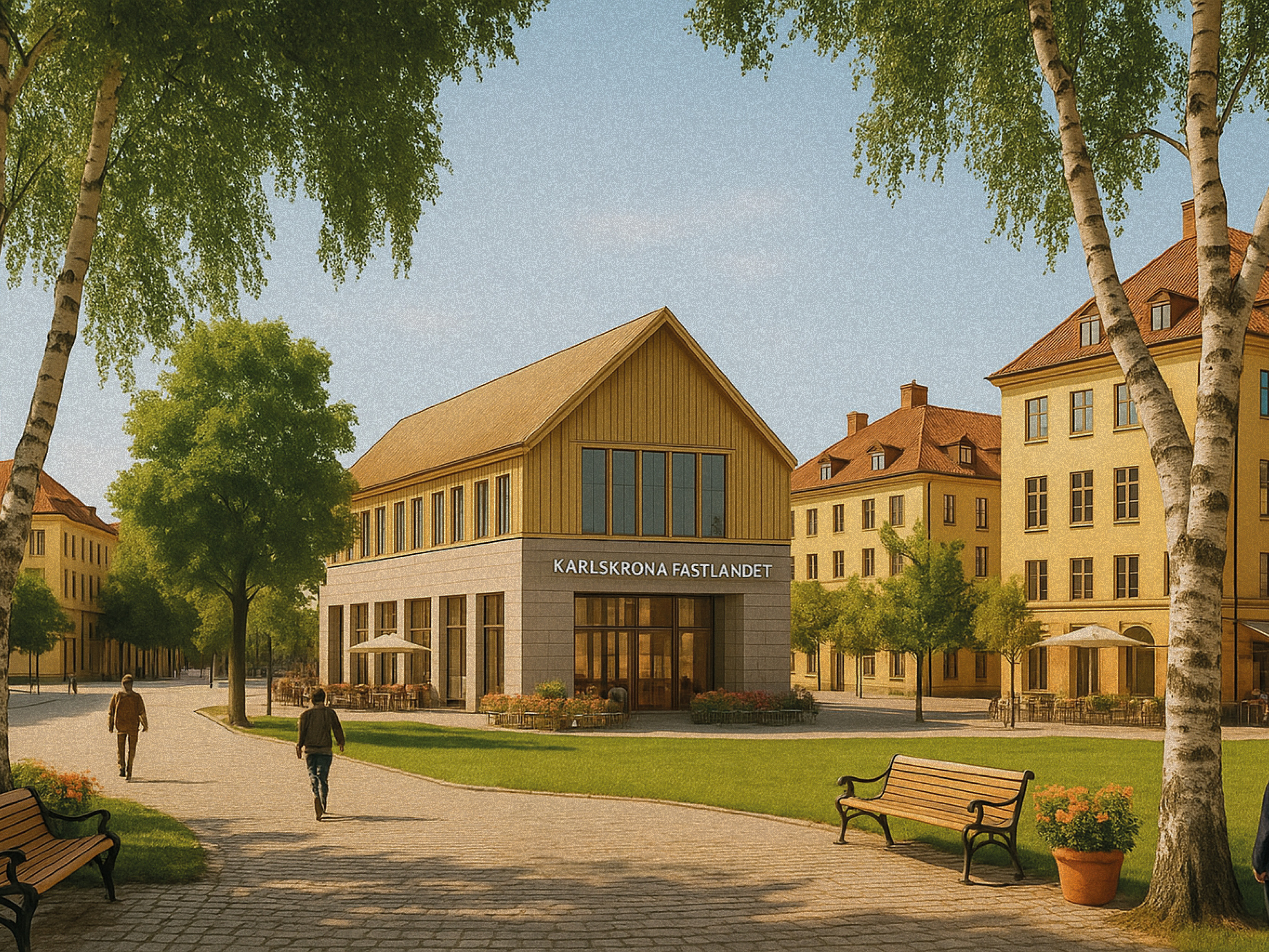
Fastlandet 2040 is an ambitious development proposal that advocates the establishment of a vibrant district where residents and visitors can thrive. The proposal aims to create a sustainable growth axis for the city, attracting businesses, talent, and tourism while alleviating bottlenecks. The homes are designed to be durable, instill pride, and harmonise with the baroque architecture of the southern city.
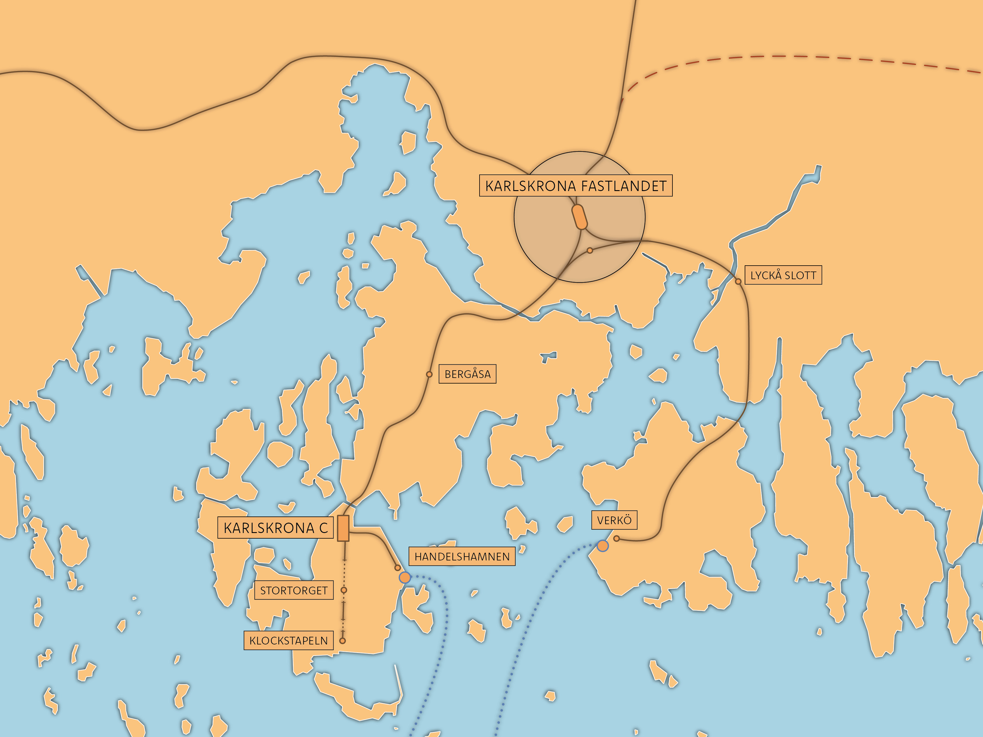
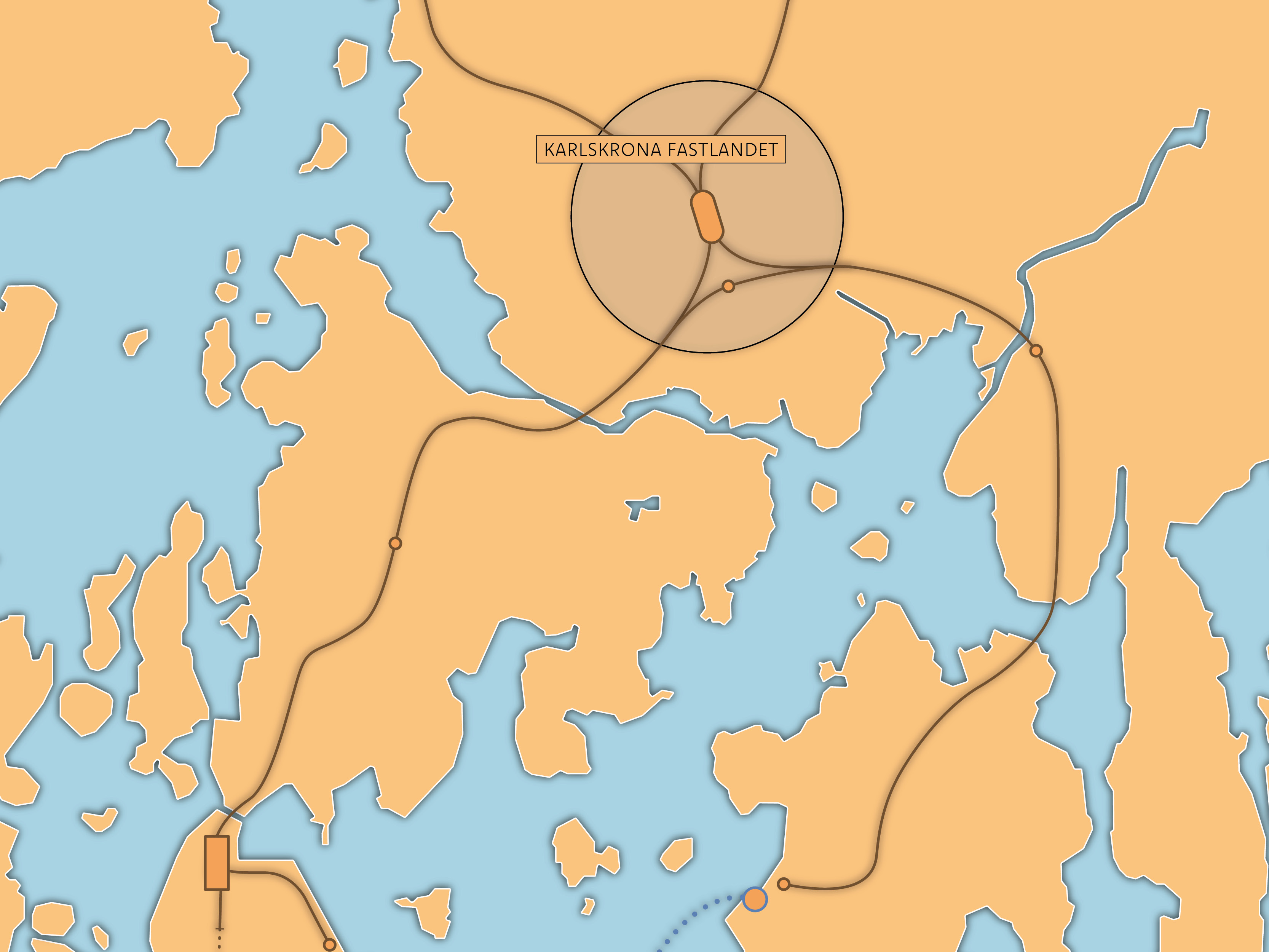
At the heart of the development is a brand new multi-modal railway station serving international, national, regional, and local passengers, as well as through running freight traffic. The facility provides a firm anchor allowing businesses and individuals to invest long-term, and grow with the city. Developing a clear vision, and eventual detail masterplan, is essential in allowing stakeholders to engage and plan.
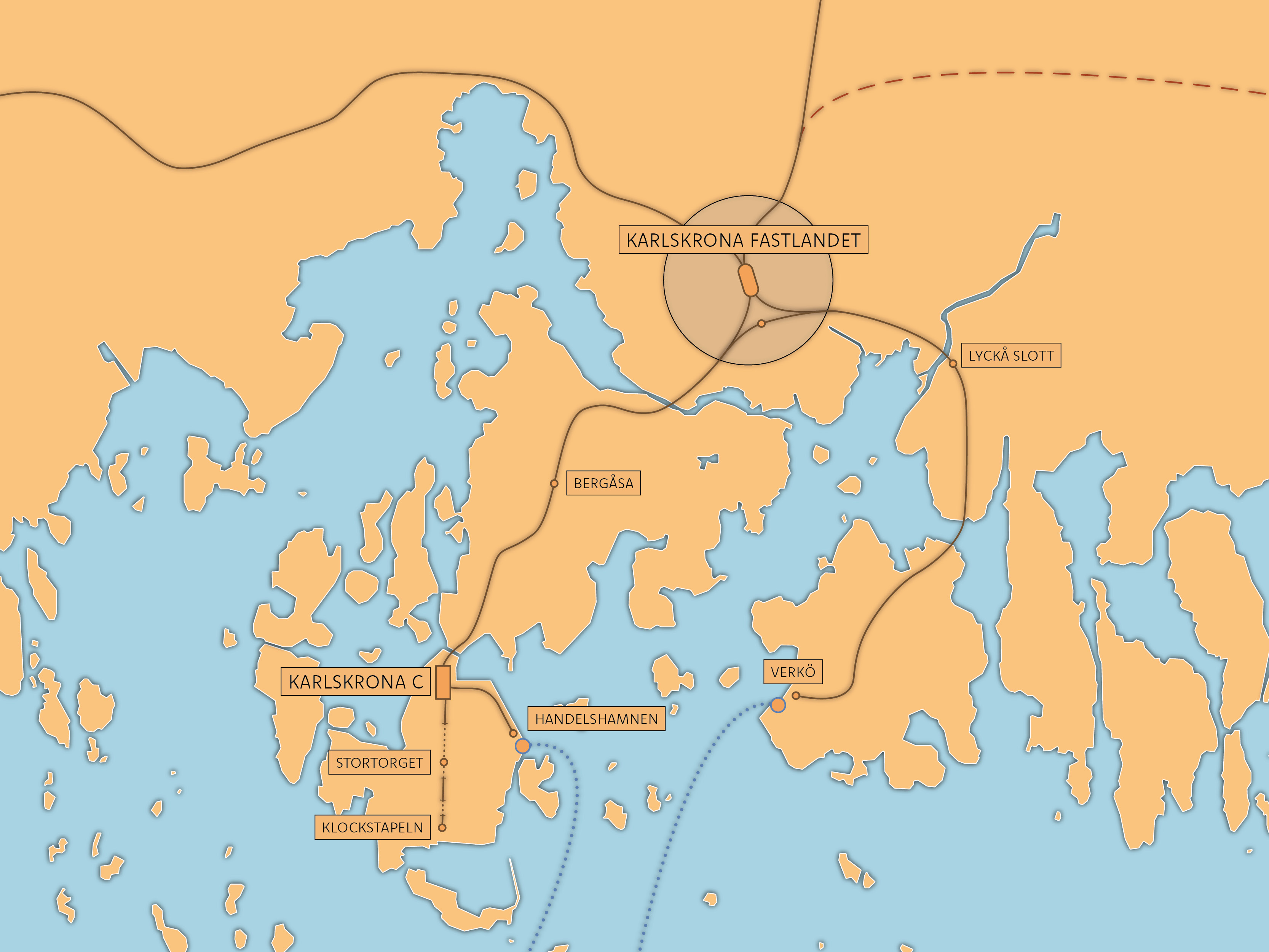
The new railway station serves as a pivotal hub for efficient commuting, linking regional, national, and international rail networks. This strategic addition significantly broadens travel options for residents, facilitating the reestablishment of direct services to Stockholm and expediting journeys to Malmö and Copenhagen. Furthermore, it seamlessly connects the ferry terminal and NKT with Karlskrona and the broader Swedish rail system.
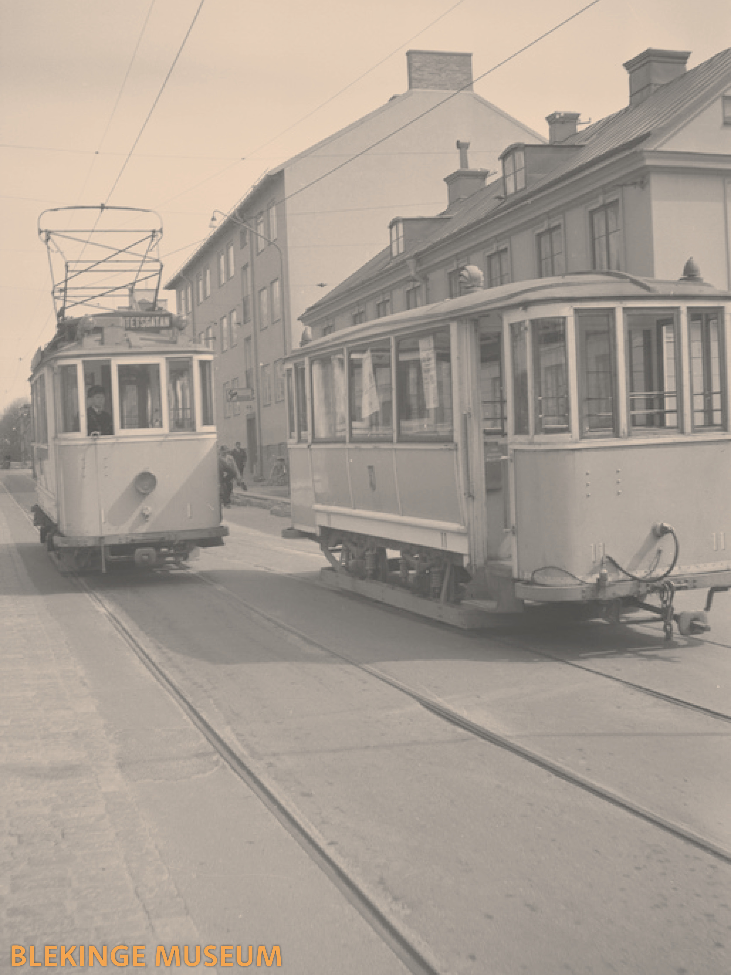
As part of the proposal, trams(/light rail) are reintroduced to make better use of single-track corridors, lower costs, and greatly enhance accessibility.
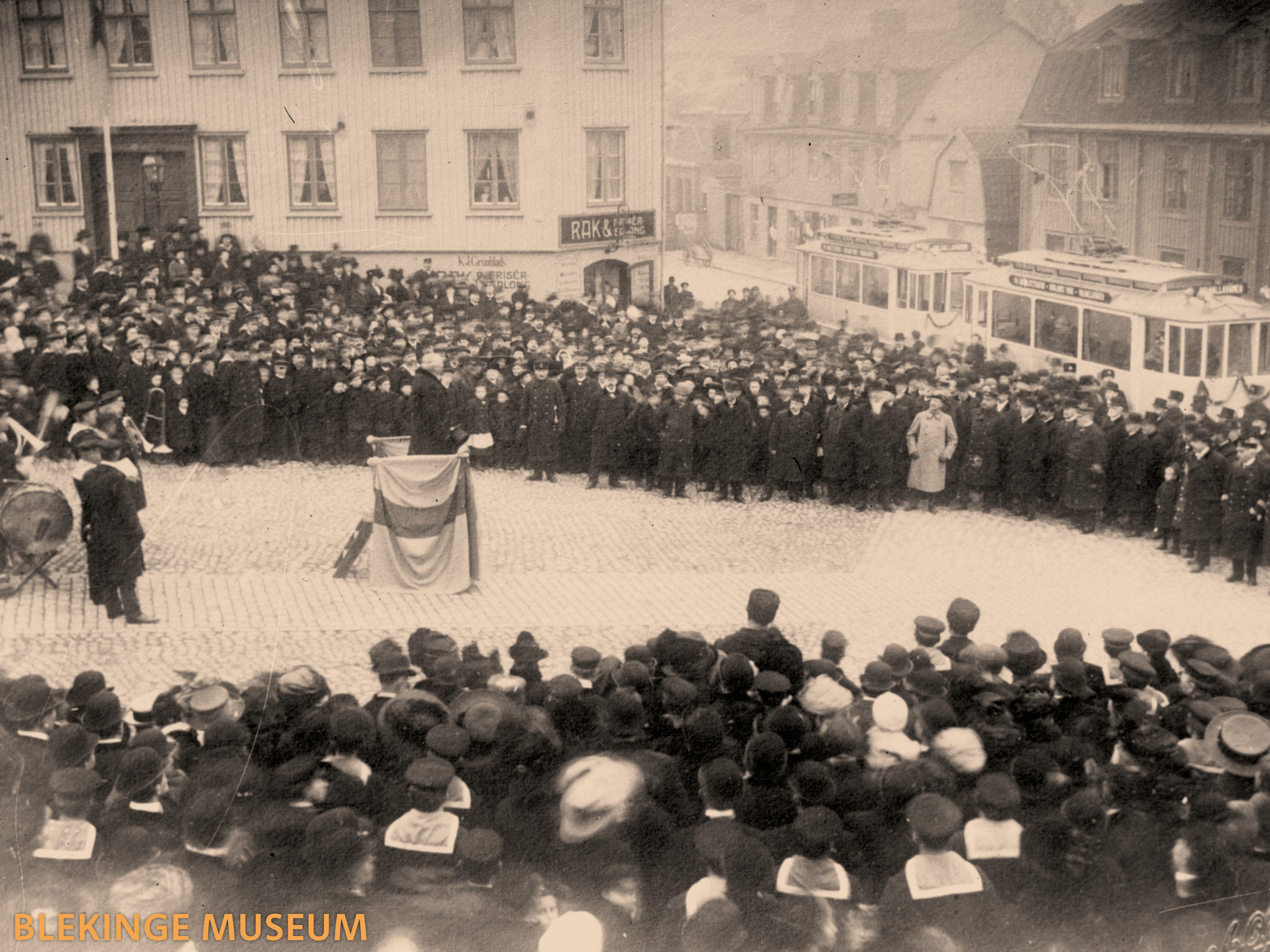
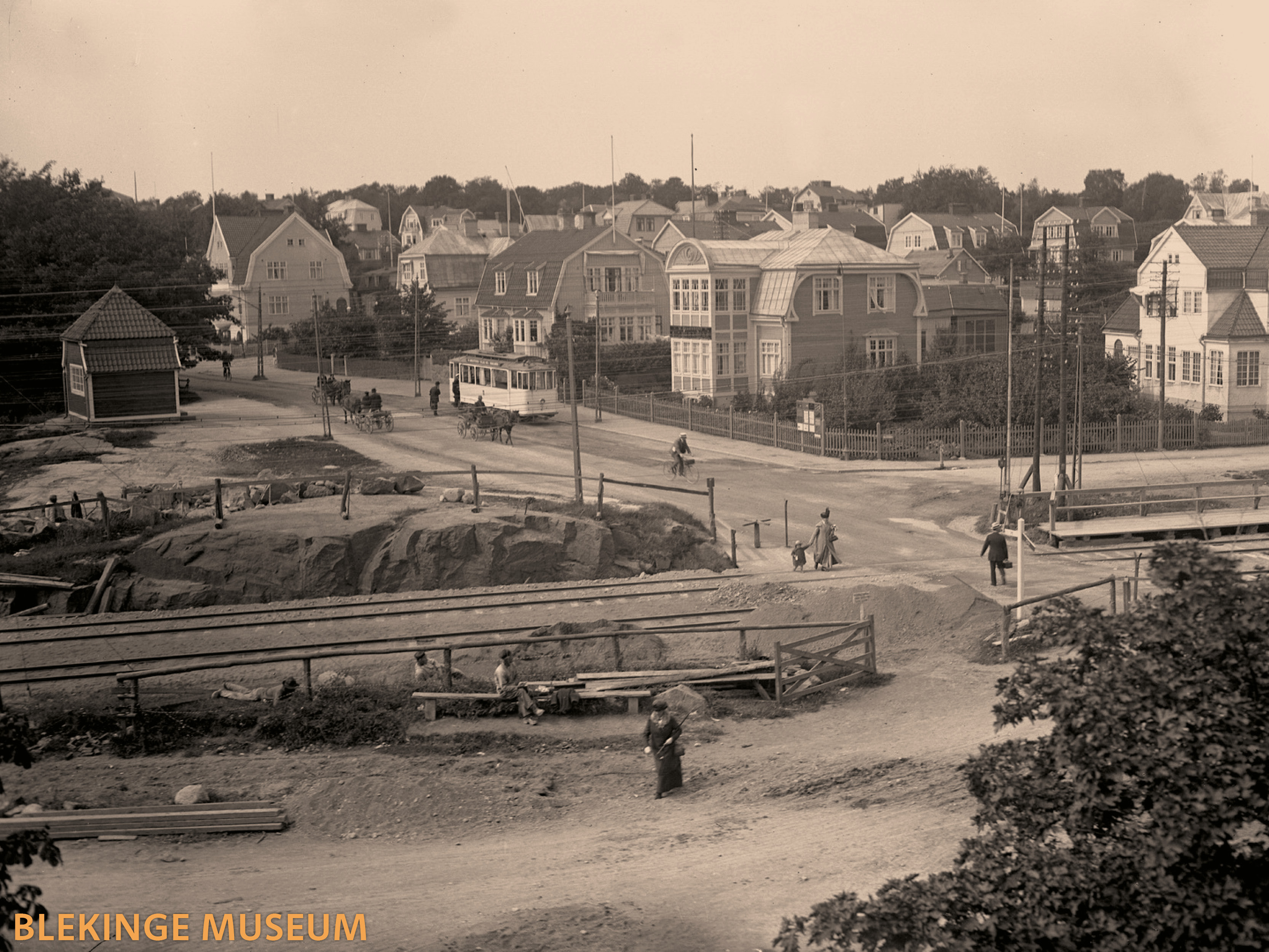
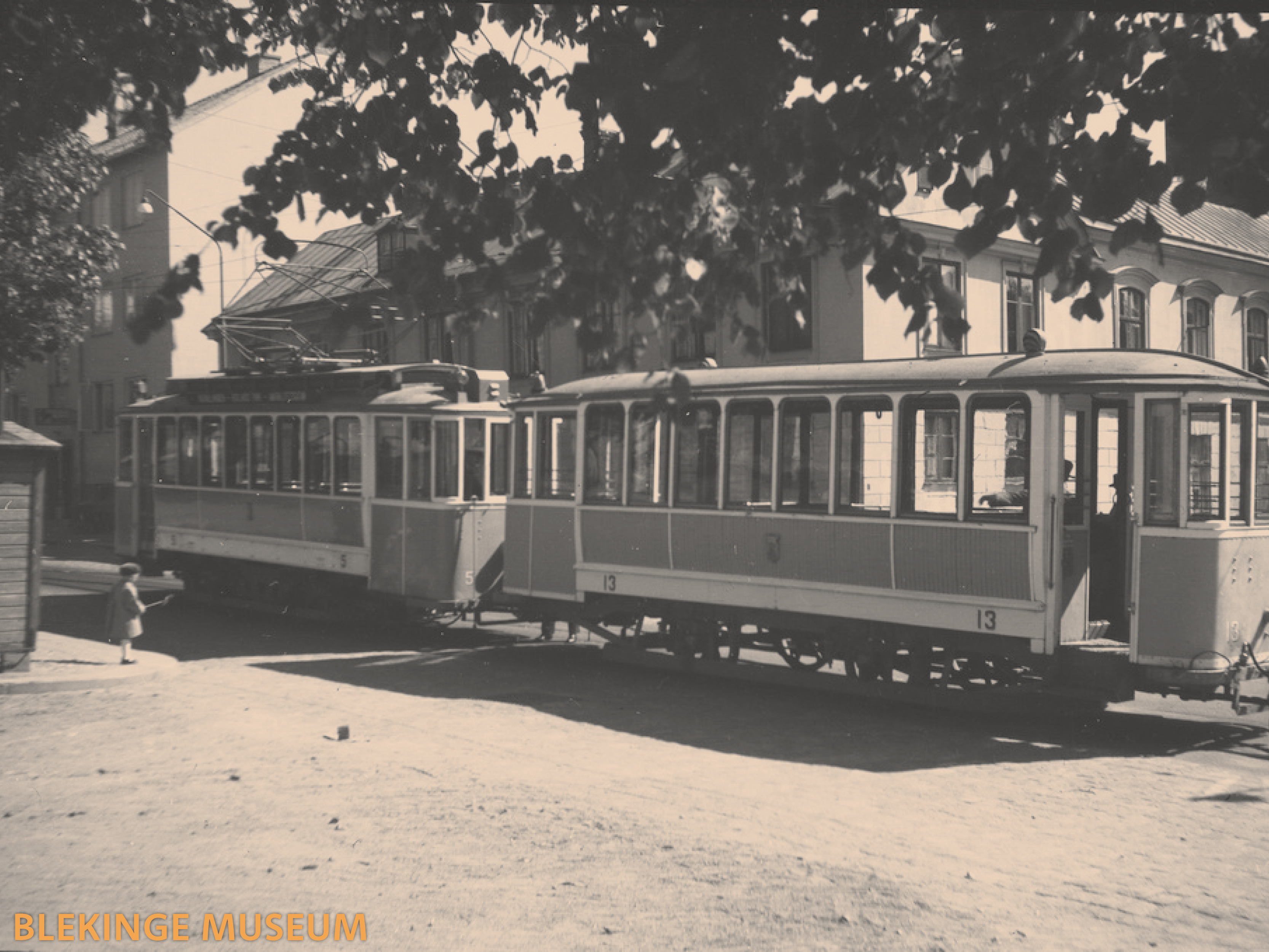
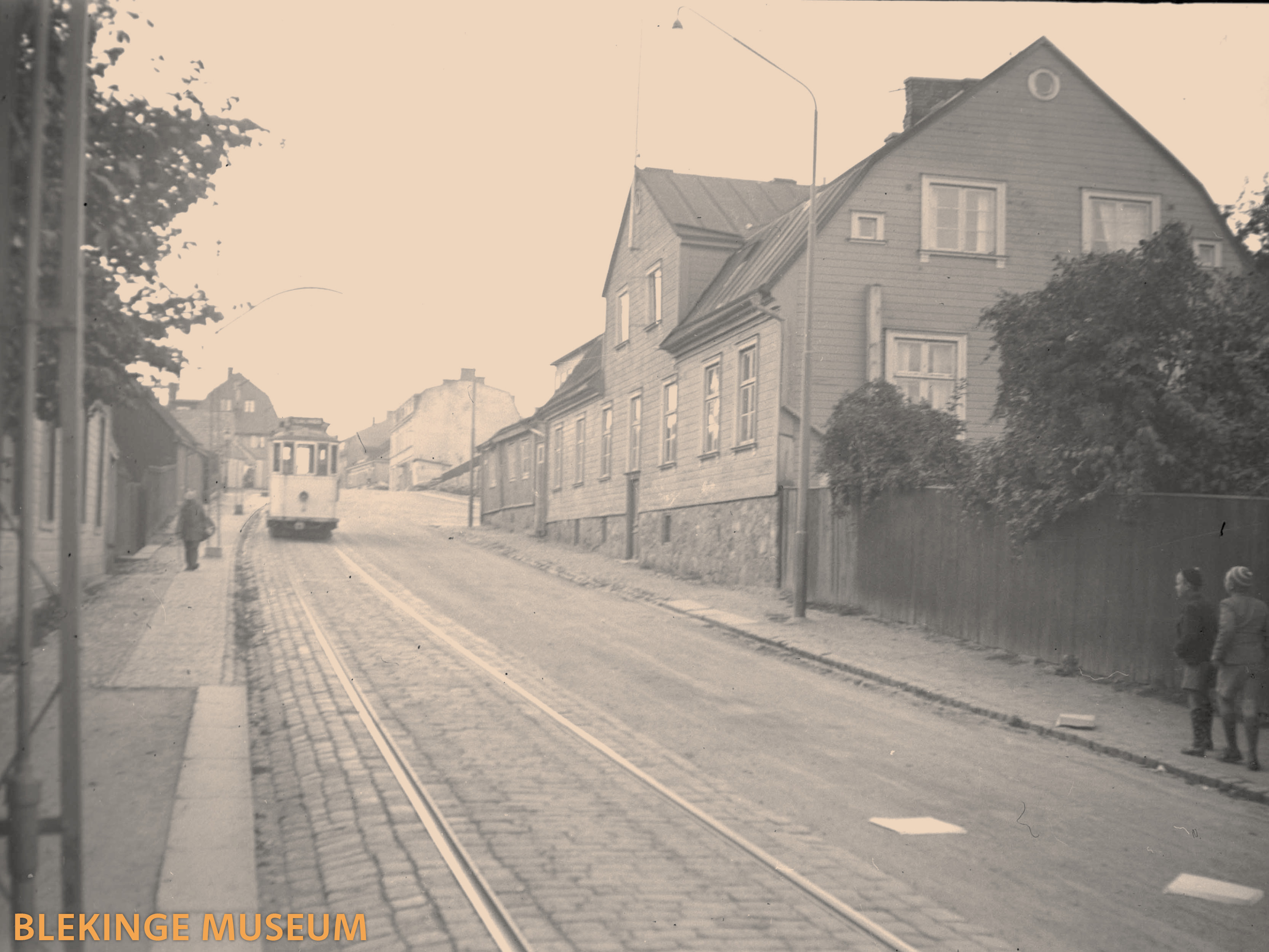
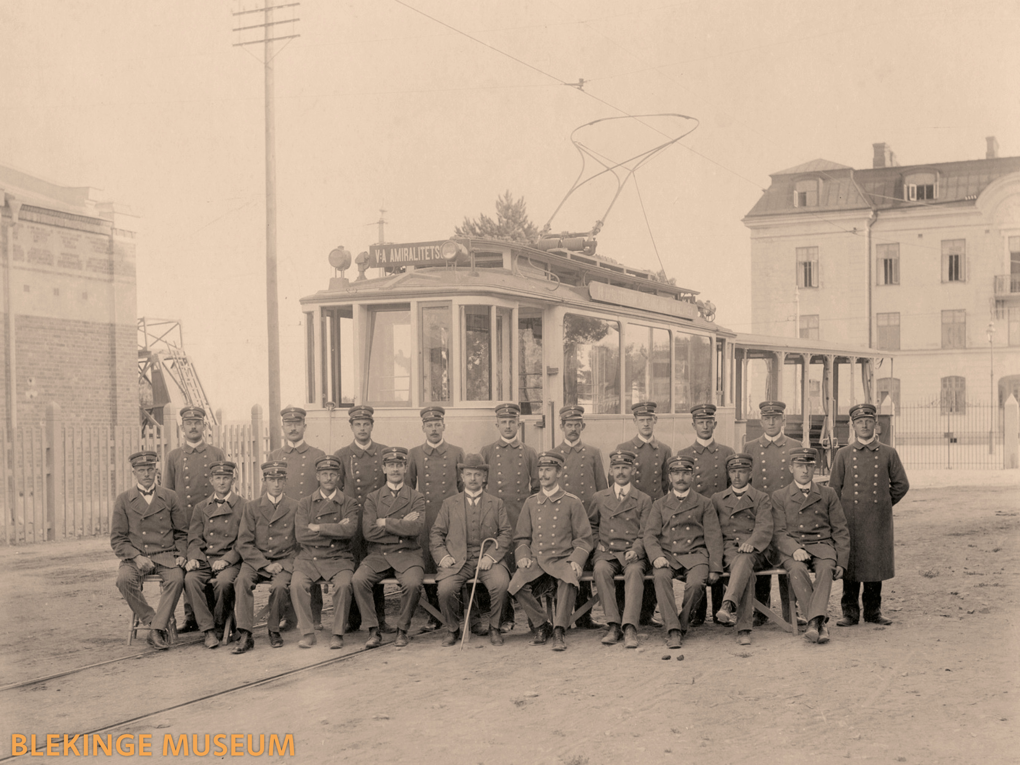
Trams were introduced in Karlskrona in 1919 but were decommissioned in 1949. Like many similar cities, this has left behind a streetscape designed for trams, featuring broad streets with gentle curves and mild inclines, which are now used for on-street parking and lack a fixed transport network. It is proven that increasing public transport ridership alongside shrewd investment improves the service overall, for both riders and drivers - a flywheel effect.
Examples of tram routes include:
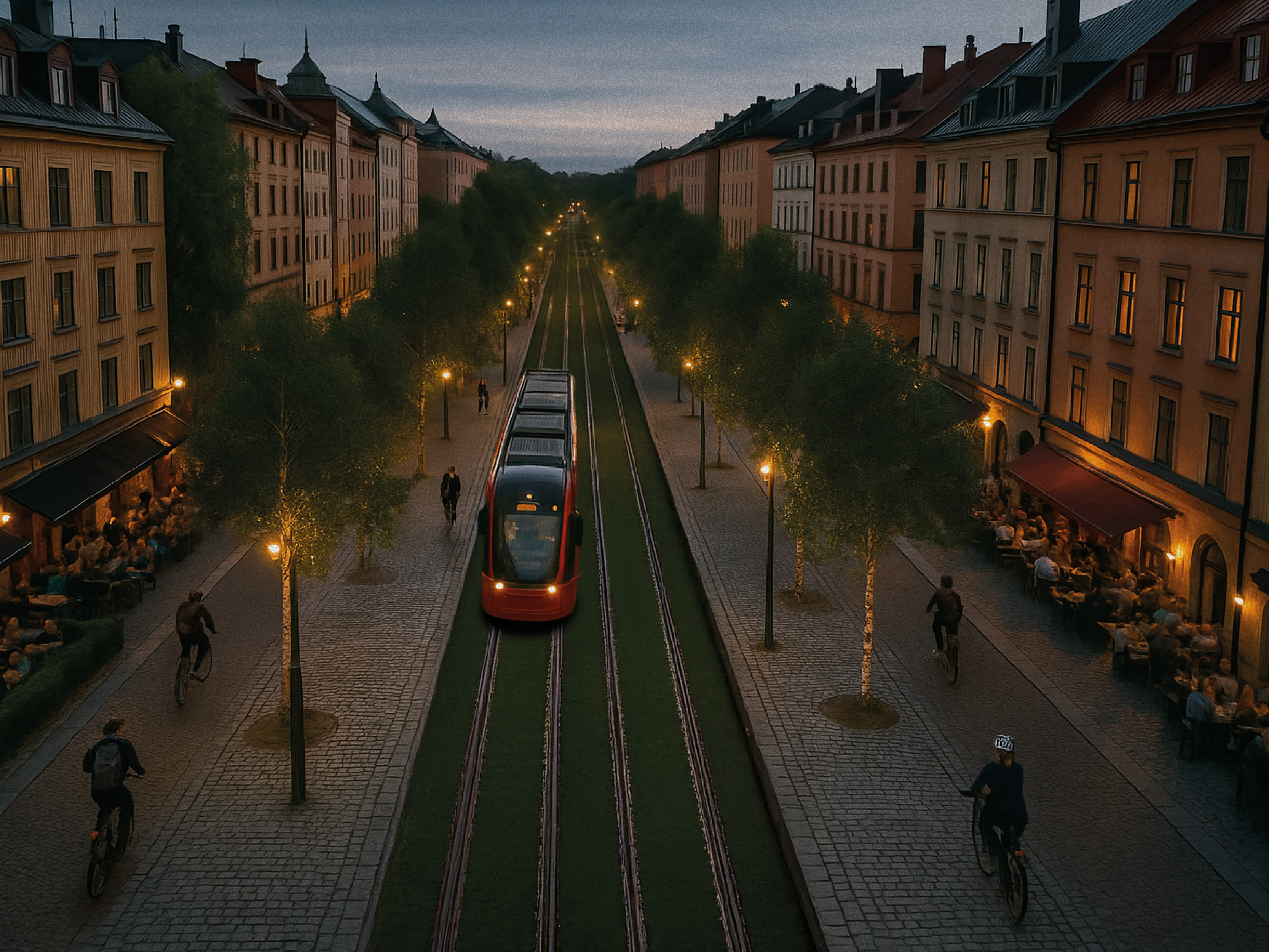
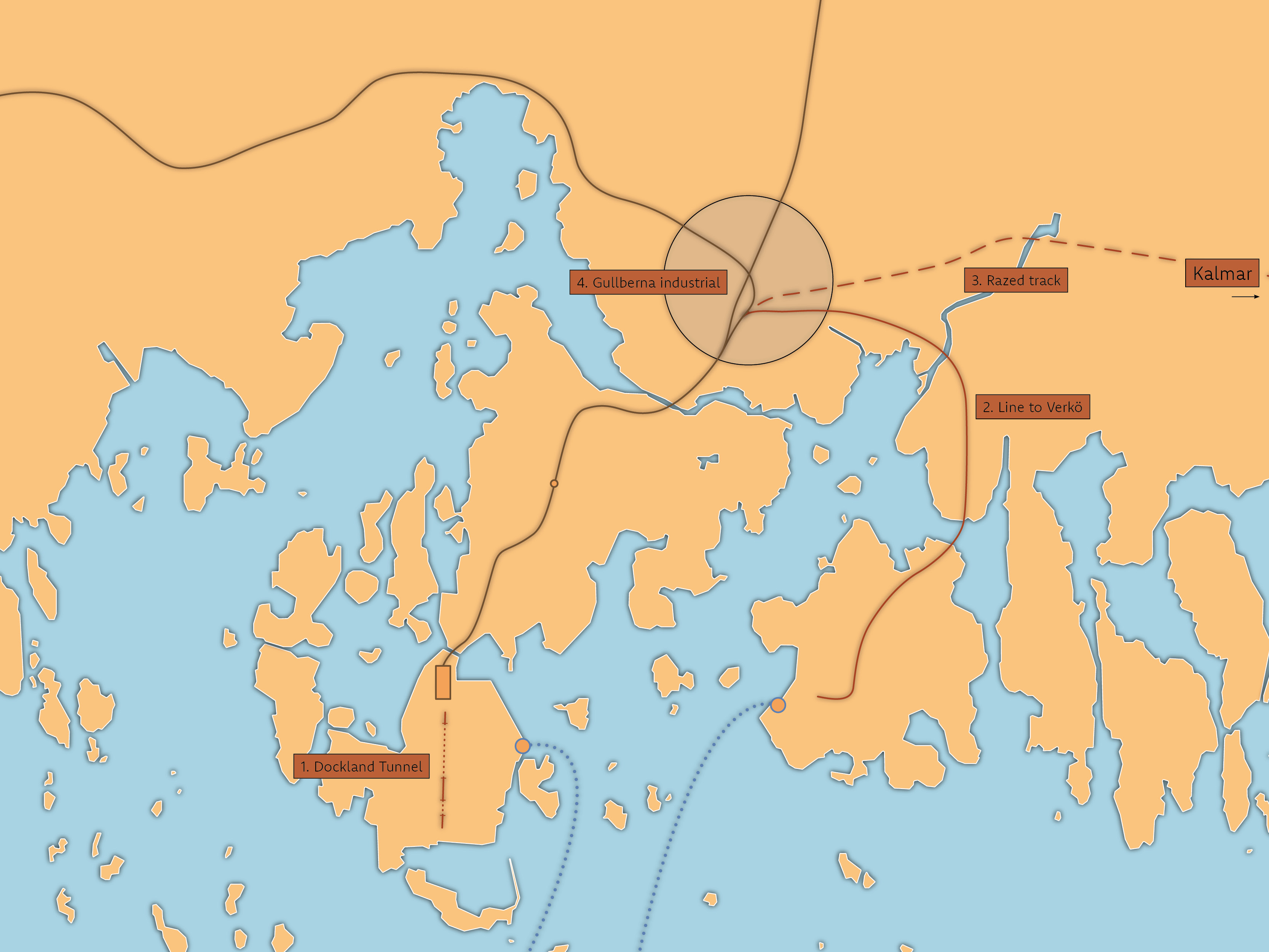
Fastlandet Station serves as a crucial junction, integrating light rail services with national rail networks. This integration is pivotal in driving the development of high-quality housing and workplaces in the new North Gullberna neighborhood.
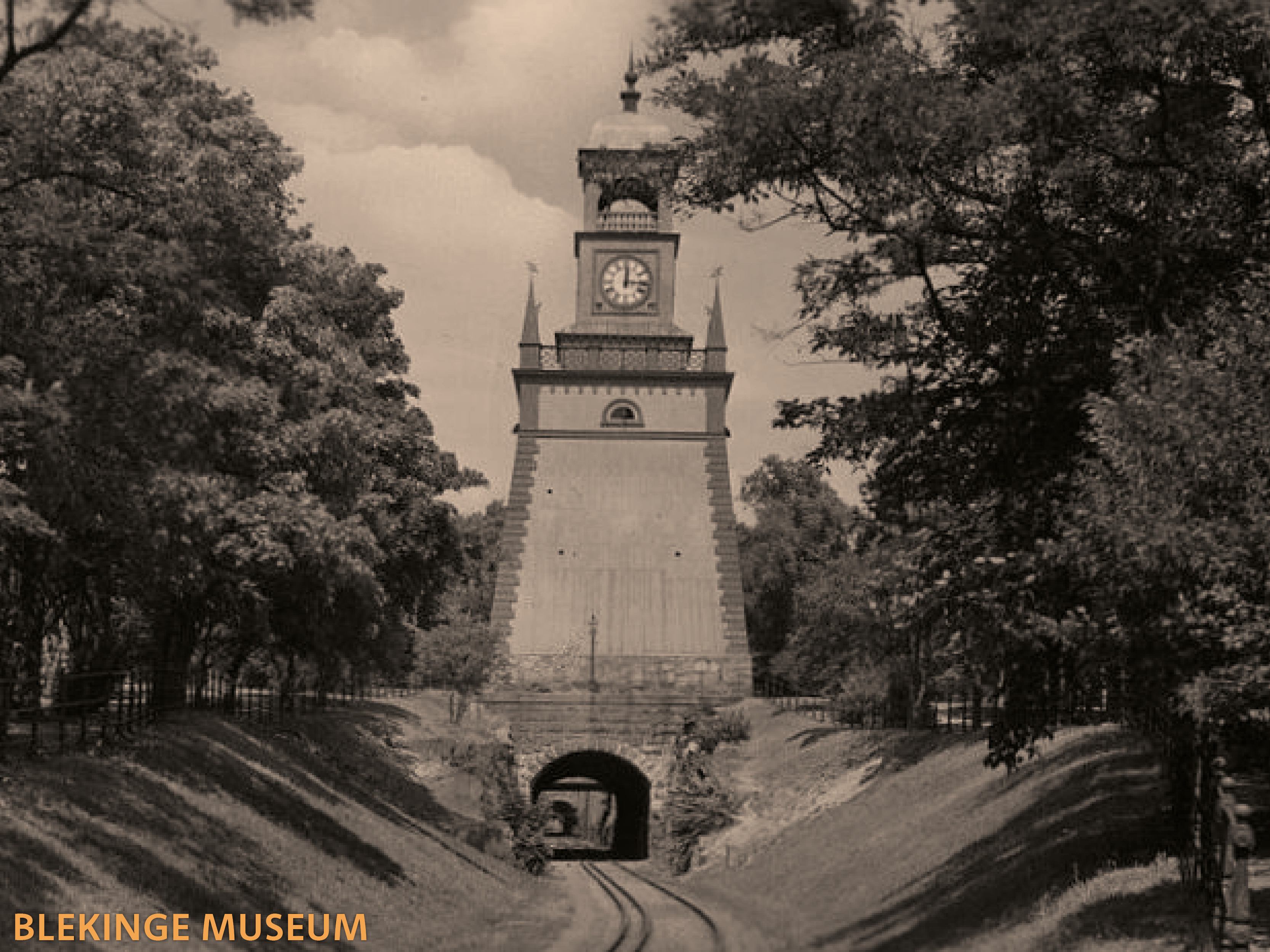
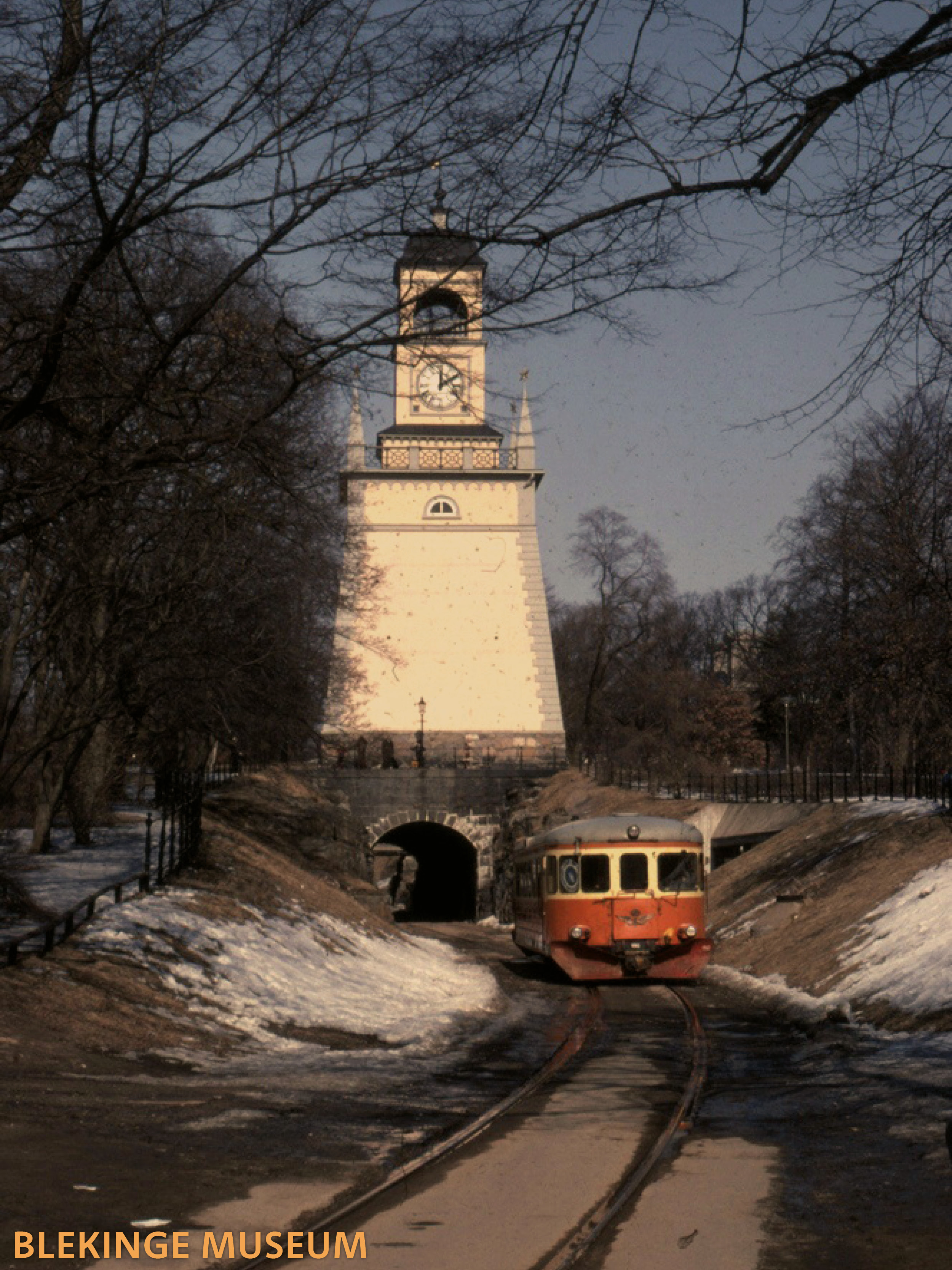
In 1887 a new railway was completed, connecting the navy docklands in the south of Trossö with the rest of the railway in the north. Built in tunnels and cuttings, the railway modernised the movement of heavy machinery and materials for constructing ships. Today, the Dockland Tunnel stands disused, yet in excellent condition. The last time it was used for transport was 1990 and since 2013 it is owned by the city.
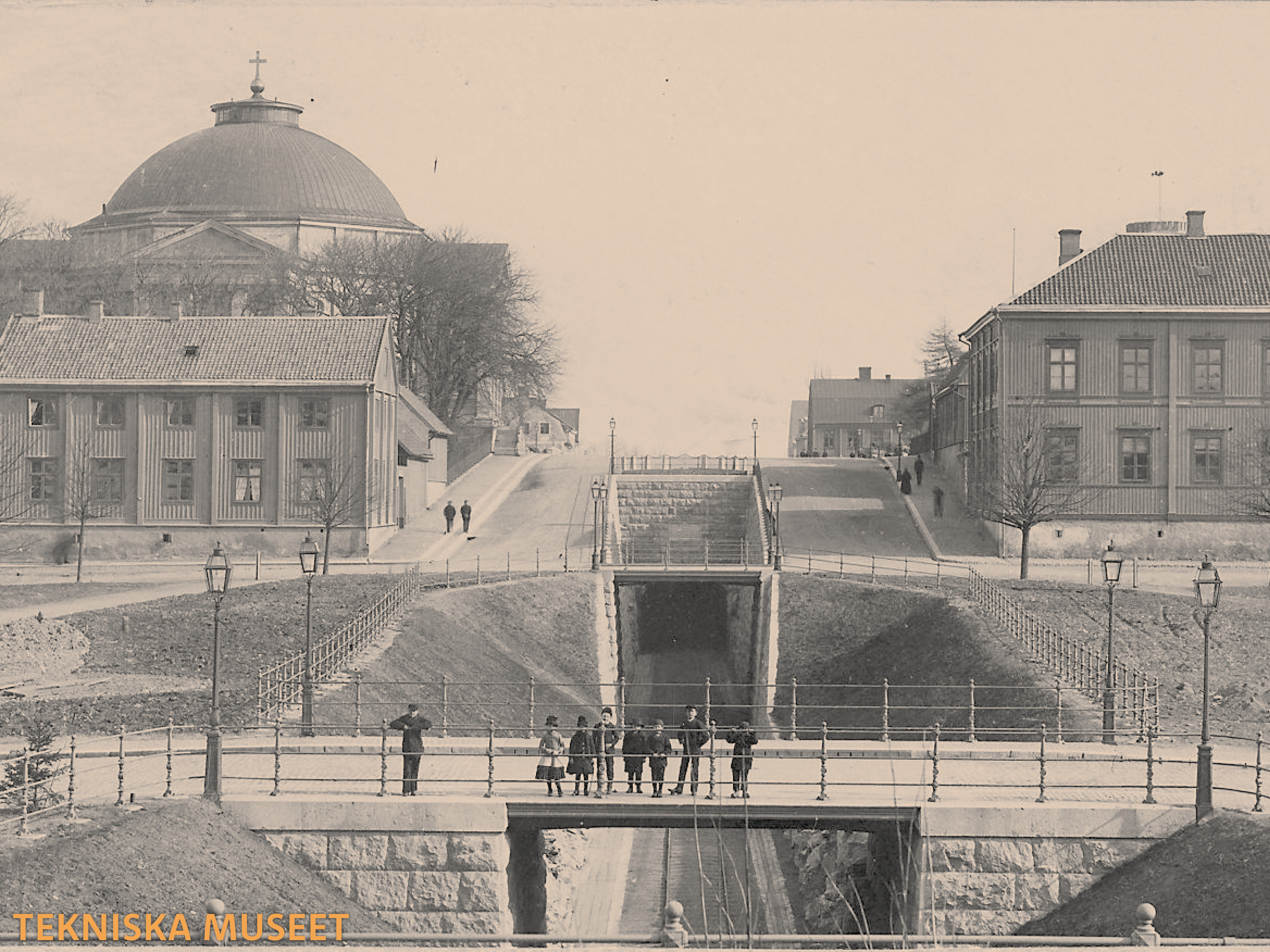
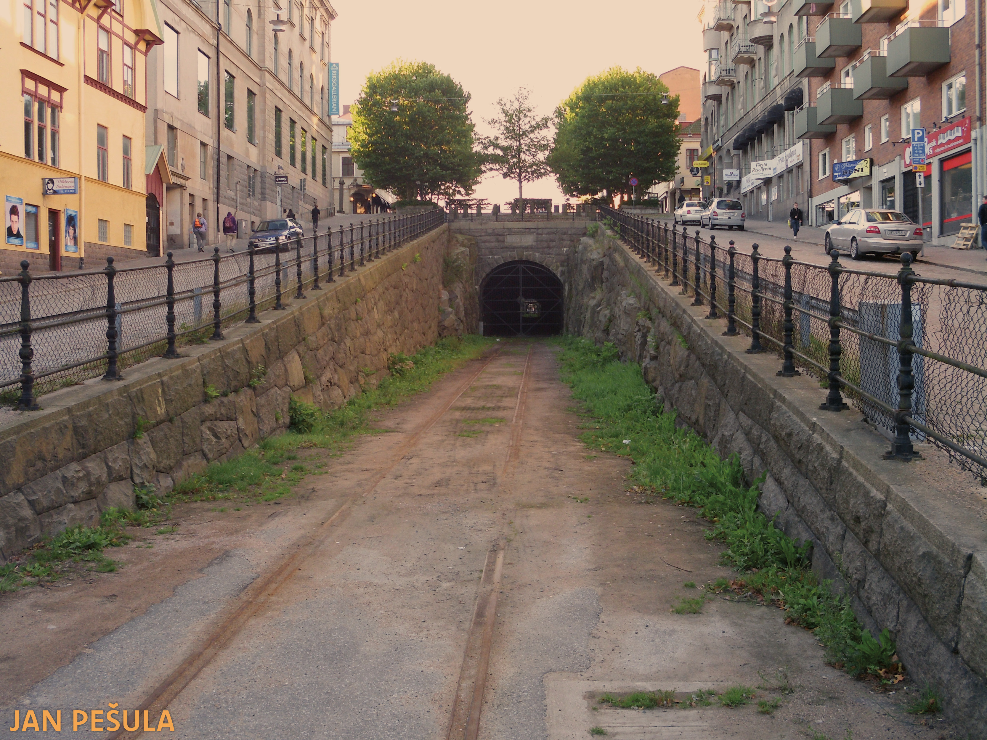
The Dockland Tunnel represents a significant opportunity. Many historic European cities would envy having a pristine subsurface railway that connects major employers, cultural institutions, and a bustling city center with national and international rail networks. Restoring this railway for tram use would greatly benefit the local population, including seasonal workers, commuters, tourists, and potentially facilitate the transport of materials for military purposes.
Reopening the line would significantly enhance Swedish defence capabilities by ensuring a more robust and well-maintained railway network. It would also free up valuable space near the Navy HQ for potential development.
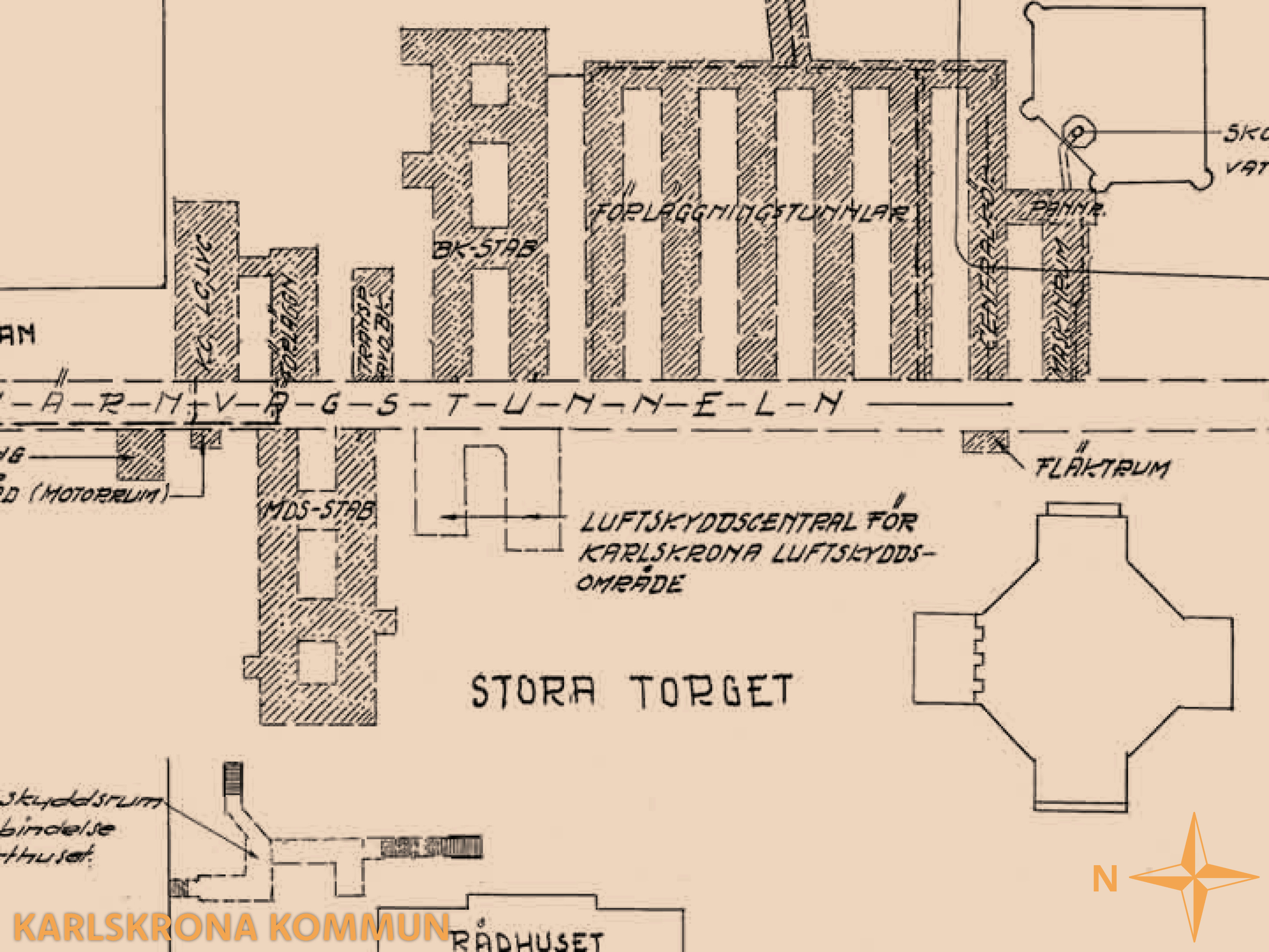
During the interwar period, excavations were conducted to create bomb shelters, which are now decommissioned. These spaces, maintained by the Swedish Fortifications Agency, were initially intended for military/war-time use but should now be repurposed for civilian application during peacetime.
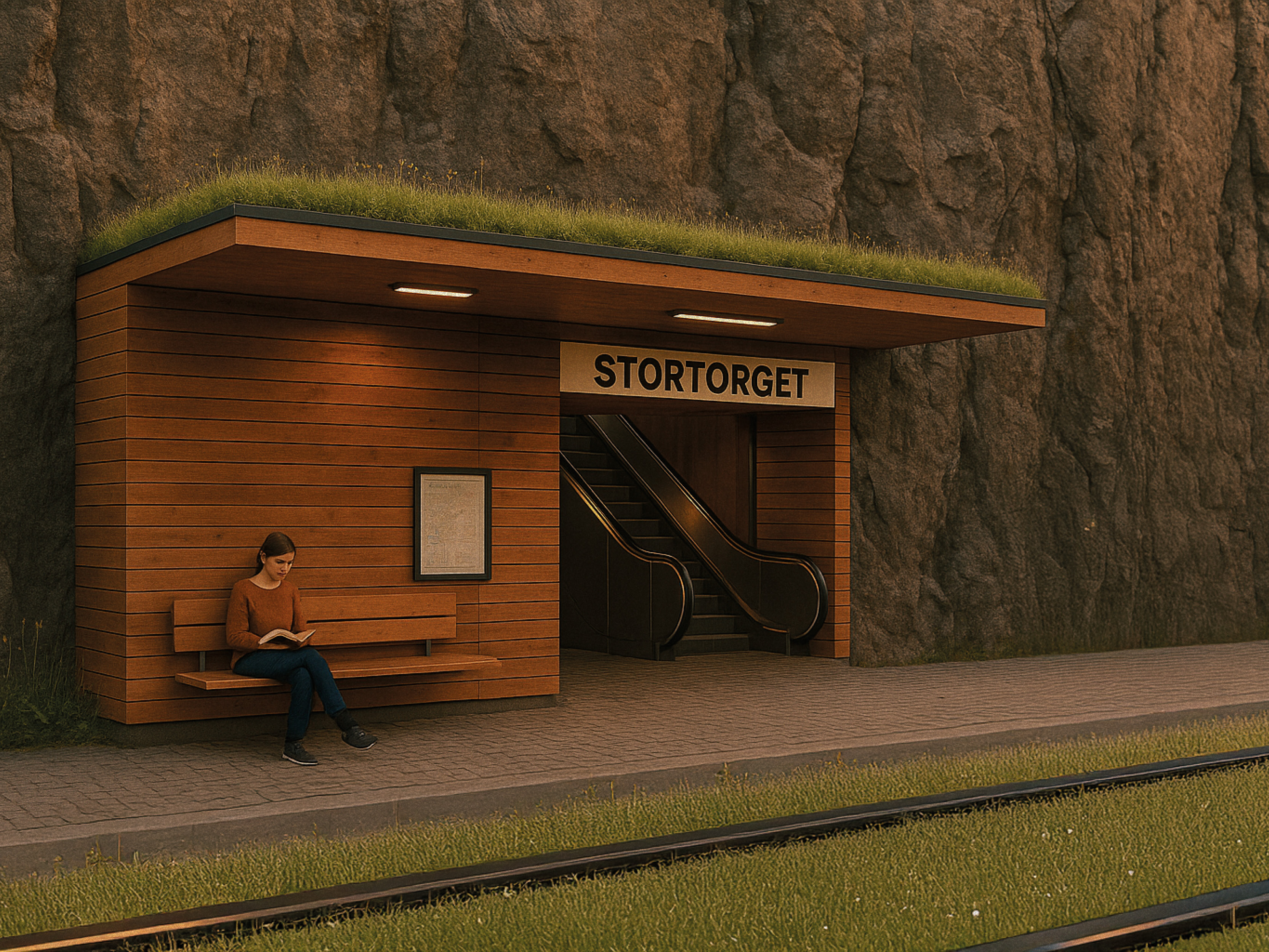
As part of this proposal, a fraction of these spaces should be transformed into a new station, linking the city center to zero-emission transit. This renovation would allow much of the area to remain available as a shelter, ensuring maintenance and familiarity for the local population. The square, currently overwhelmed by car parking, is an architectural marvel. By reintroducing a tram network to connect with the mainland, it frees up space above ground, turning the square into a vibrant meeting place and a symbol of community identity.
Karlskrona stands at a pivotal moment. The challenges the city faces - housing shortages, limited connectivity, and stagnant growth - demand not just recognition but strategic response. This proposal outlines a path forward: evidence-based, infrastructure-led, and rooted in local context. It leverages existing assets to create long-term value - social, economic, and environmental. To realise this vision, coordination between municipal agencies, regional actors, and national stakeholders is essential. With clear priorities, decisive planning, and sustained political will, Karlskrona can transform constraint into capacity.